Montenegro Coastal Road Trip: Herceg Novi to Ulcinj
Drive the whole Montenegro coast: Herceg Novi, Kotor, Budva, Sveti Stefan, Bar and Ulcinj - distances, the Kamenari ferry and where to stop.
The Montenegrin coast is short enough to drive end to end in a long weekend and varied enough to fill a week: about 125 km of Adriatic shore from the Croatian border to the Albanian one, taking in a walled medieval port, the country’s busiest resort, its most photographed islet, a ruined hill town and Europe’s longest sand beach. This itinerary runs the whole seaboard, north to south - Herceg Novi → Kotor → Budva → Sveti Stefan → Bar → Ulcinj - in a relaxed four days, with a hire car doing the work. The distances are tiny; the time goes on old towns, swimming and the slow single-lane coast road, not on motorway miles.
This is deliberately the full-coast drive, not the bay: if you only want the inner Bay of Kotor loop - Kotor, Perast, Lovćen - that is our Bay of Kotor coast itinerary. Here we keep going south past Budva to the open coast most bay-based visitors never reach: Petrovac, Bar, and the long, wild beaches around Ulcinj. It pairs well with the wider Montenegro road trip if you then want to turn inland for the mountains - and if you do turn north, the Durmitor Ring road trip is the mountain half of the same journey.
How long: a weekend, four days or a week?
Three days gets you the headline coast at a jog: the bay, Budva and Sveti Stefan, then a fast run south. Four days - the pace this plan is built around - adds proper time in Ulcinj and the Velika Plaža beaches, the most distinctive part of the south. A week lets you swim more, add Petrovac or a Skadar Lake detour inland, and never feel rushed on the coast road, which is slower than the map suggests.
| Pace | What you fit in | Where you sleep |
|---|---|---|
| Weekend | Herceg Novi, Kotor, Budva, Sveti Stefan | Kotor or Budva |
| 4 days | + Bar, Ulcinj and Velika Plaža | Budva + Ulcinj |
| A week | + Petrovac, more beach time, a Skadar Lake day | Spread down the coast |
The distance, days and budget on the summary card are a guideline, not an exact measurement - they shift with how many swims you fit in, the season and where you sleep. The budget from €55 figure is a rough daily floor per person in shoulder season (a modest room, a shared hire car, simple meals); the south (Bar, Ulcinj) runs cheaper than Budva, and high summer on the whole coast is well above it.
Herceg Novi: the gateway
The coast road crosses into Montenegro at the mouth of the Bay of Kotor, and the first town is Herceg Novi - the sunniest on the coast, and the one visitors from Dubrovnik hit first. It is built up a steep slope in tiers of stairs and squares, with two seafront fortresses (Kanli Kula and Forte Mare) and the long Pet Danica promenade running along the water. It is a good place to shake off the drive, walk the old town’s steps and get your first swim before pushing on around the bay.
From here you have a choice that shapes the day, and it is worth understanding before you set off.
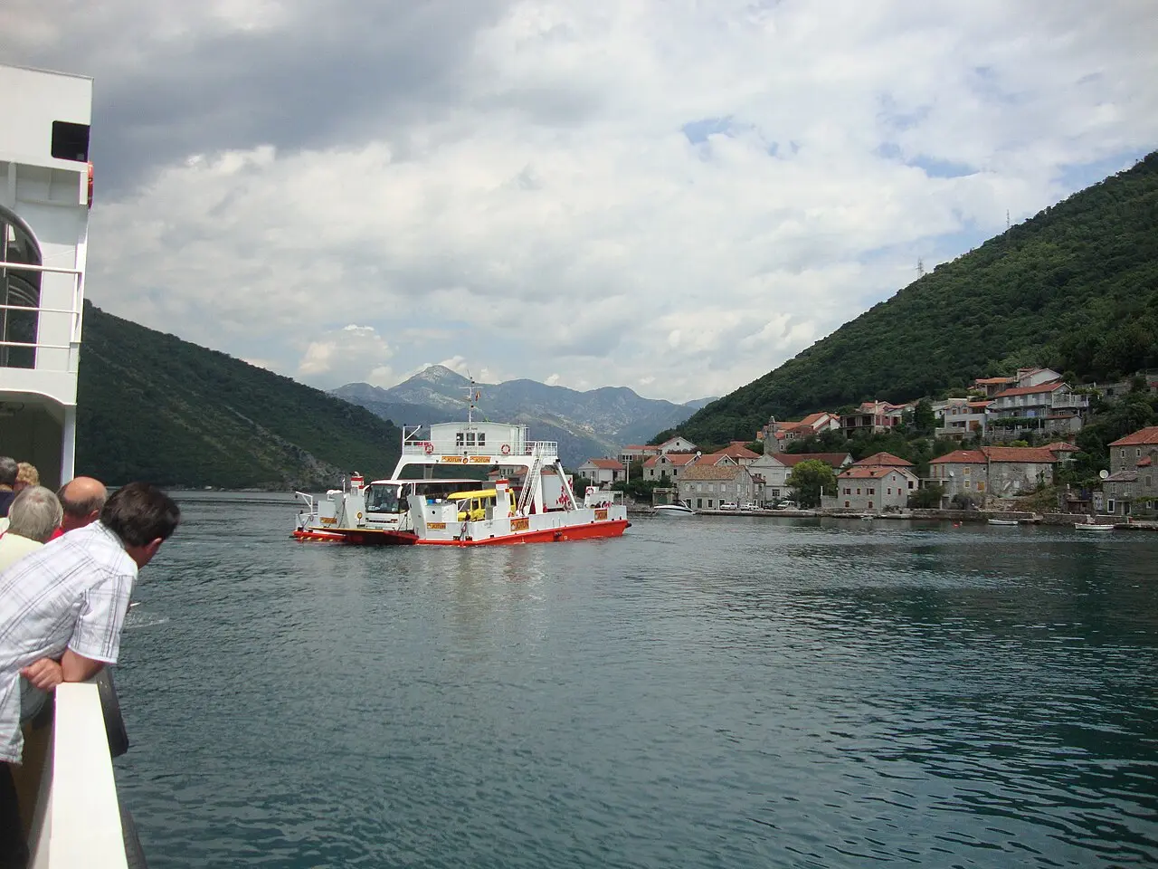
The Kamenari ferry, or around the bay?
Just past Herceg Novi the road splits at Kamenari. Carry on around the inner bay through Risan and Perast to reach Kotor at the head - the scenic way, about 43 km and under an hour off-season, longer and lovelier if you stop. Or take the Kamenari-Lepetane car ferry straight across the Verige narrows to the Tivat side, cutting roughly 30 km and 35-40 minutes if you’re heading for Budva and the open coast rather than Kotor itself.
The ferry runs constantly - every 20 minutes by day in summer, every 30 at night - the crossing takes about five minutes, and it costs around €5 for a car (pedestrians and cyclists free; check the current fare). The one catch is July and August queues, which can hit 45-60 minutes in the morning and evening rush. My rule: if Kotor is on today’s list, drive around the bay; if you’re pressing south, take the ferry. Either way, the practical side - fares, tolls, buses - is covered in getting around Montenegro.
Kotor: the walled old town
However you arrive, give Kotor a good half-day. The old town is a UNESCO World Heritage Site, entirely car-free, so park outside and walk in through the Sea Gate to a warren of stone lanes, small squares and the Romanesque Cathedral of Saint Tryphon. The big effort is the climb up the city walls to the Fortress of San Giovanni on the ridge - roughly 1,350 steps and a sweeping view over the rooftops and the fjord-like bay. Go early or near sunset to beat the heat and the cruise crowds. Full details are in our Kotor guide.
Kotor is the northern anchor of the coast and a fine first overnight, especially once the day-trippers leave and the lanes empty out.
Budva and Sveti Stefan
South of the bay the road reaches the open Adriatic and Budva, about 22 km on from Kotor - the busiest, brashest resort on the coast. There is a compact Venetian old town on a little peninsula, a citadel, a marina packed with yachts, and a string of beaches from Slovenska Plaža in town to Mogren and the wider Jaz just west. It is also the country’s nightlife capital, which makes it either the ideal second base or the place you gladly leave, depending on your trip. See our Budva guide for the old town and beaches.
A few kilometres south is Sveti Stefan, the fortified islet that fronts every Montenegro brochure. It is a former fishing village turned exclusive resort, joined to the shore by a slim causeway; the island itself is private and usually closed to non-guests, but the classic view is free from the viewpoint on the main road above, and the beaches either side of the causeway are open. Stop for the photo, swim if you have time, then carry on south - this is where most itineraries turn back, and where the more interesting half of this one begins.
Bar and Stari Bar
The coast south of Sveti Stefan is quieter and cheaper. Past the pretty little resort of Petrovac, about 35 km on from Budva, comes Bar - the country’s main commercial and ferry port, with seasonal summer sailings to Bari and Ancona in Italy (details in our ferry to Montenegro guide). Modern Bar is a working town, not a resort, so don’t linger on the waterfront.
The reason to stop is Stari Bar (Old Bar), about 5 km inland. It is a walled hill town that nobody has lived in for over a century - a ruined maze of houses, churches and an aqueduct behind the walls, wrecked by a 19th-century explosion and a 1979 earthquake, now a quietly atmospheric open-air site with a few cafes and craft shops in the lanes below. Nearby at Mirovica stands the Stara Maslina (Old Olive Tree), reckoned to be over 2,000 years old and one of the oldest in Europe. It is the most surprising hour on the whole coast.
Ulcinj and Velika Plaža: the end of the road
The last town is Ulcinj, about 25 km on and the southernmost on the coast, right up against Albania. It feels different from the rest - a walled old town (Stari Grad) on a rocky headland above the harbour, minarets on the skyline, and a strong Ottoman-Albanian character you won’t have met further north. The town beach in the bay is small and busy; the real draw is a few kilometres south.
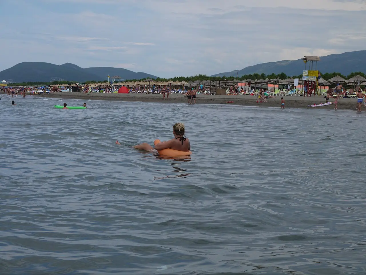
That is Velika Plaža (Long Beach) - about 12-13 km of open sand running from Port Milena to the Bojana river, the longest beach in Montenegro and one of the longest in Europe. It is shallow, warm and backed by dunes and scrubby forest, which makes it the Adriatic’s premier kiteboarding spot and a complete contrast to the pebble coves up north. At the far end, the river island of Ada Bojana marks the Albanian border, with birdlife, stilt-house fish restaurants and a famous nudist beach. This is the end of the coast road, and a fitting place to stop.
Driving the coast: what to know
An easy self-drive, with a few coast-road realities worth planning around:
- The road is single-lane and slow. The Jadranska Magistrala (Adriatic Highway) is mostly one lane each way, winding and busy. In July and August it becomes a slow procession - budget 2-4 hours for a 60-70 km hop, far more than the distance suggests. Off-season it is a joy.
- The Kamenari ferry. Around €5 a car, runs constantly, saves ~30 km past the inner bay - but expect summer queues at peak times. Take it when you’re skipping Kotor.
- Tolls and cash. The coast road is toll-free; only the inland Sozina tunnel (Bar-Podgorica, on the E80) carries a small toll if you cut inland. Carry euro coins for parking machines and small cafes.
- A small car is best. Old-town parking is tight and fills fast in summer; a compact car is easier everywhere. Our guide to renting a car in Montenegro covers pickup points and keeping costs down. For the pick of the sand along the way, see the best beaches in Montenegro.
Montenegro uses the euro (€), even though it is not in the EU; cards work in towns, but carry cash for parking, beach loungers and small places, especially in the south. To fit this coast into a bigger loop, see the full Montenegro road trip, and browse more ready-made routes for ideas inland.
Nearby / read also
- Best beaches in Montenegro - where to swim along this coast.
- Bay of Kotor coast itinerary - the shorter inner-bay loop.
- Durmitor Ring road trip - the mountain half, if you turn inland after the coast.
- Budva guide · Kotor guide · Bar · Ulcinj
- Renting a car in Montenegro - pickup points, roads and costs.
- Ferry to Montenegro - the summer boats into Bar from Italy.
- All routes in Montenegro - more driving ideas.
Route day by day
- Days on the road
- 4
- Distance
- ≈125 km
- Budget from
- 55 EUR
- Best season
- May, June, September, October
-
Herceg Novi
Route startstop ≈180 min
The coast road enters Montenegro here, at the mouth of the Bay of Kotor near the Croatian border. A sunny old town of stairs and fortresses (Kanli Kula, Forte Mare) stacked above a long seafront promenade - the start of the drive south.
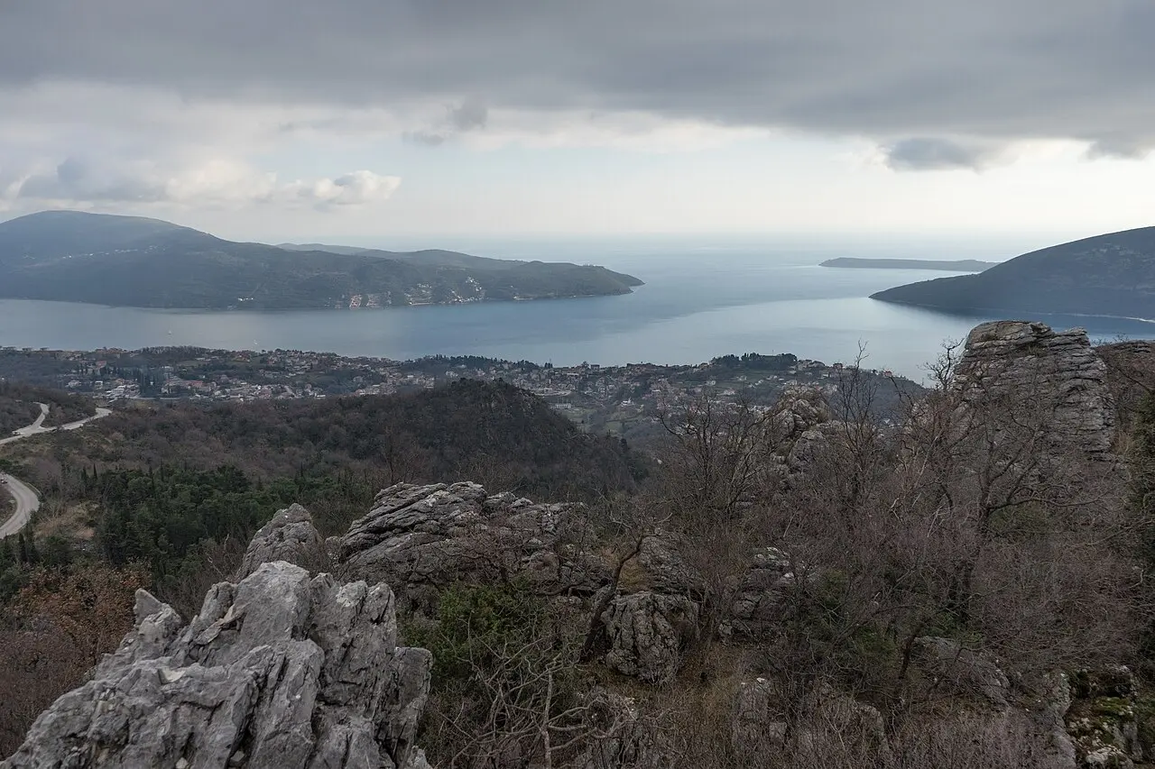
Photo: Alexkom000 / Wikimedia Commons, CC BY 4.0 -
Kotor
43 km from the startstop ≈300 min
The walled UNESCO old town at the head of the bay - car-free lanes, a Romanesque cathedral and the walls climb to the San Giovanni fortress. Reach it around the bay from Herceg Novi, or cut the corner on the Kamenari ferry.
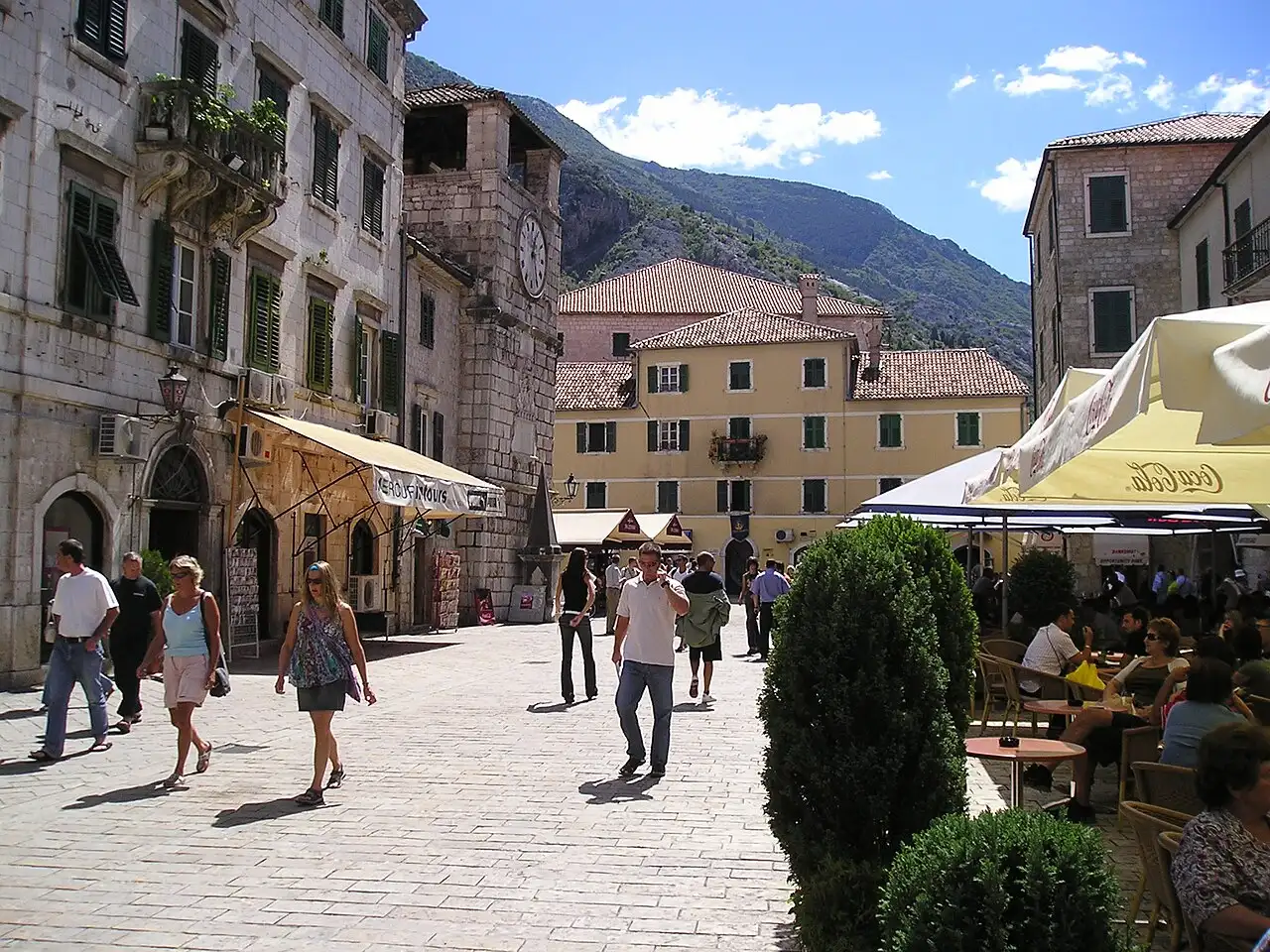
Photo: Jason Rogers / Wikimedia Commons, CC BY 2.0 -
Budva
65 km from the startstop ≈240 min
The liveliest resort on the coast: a small Venetian old town on a peninsula, a citadel, a marina full of yachts and a run of beaches - Slovenska, Mogren, Jaz. The nightlife capital, and a natural overnight.
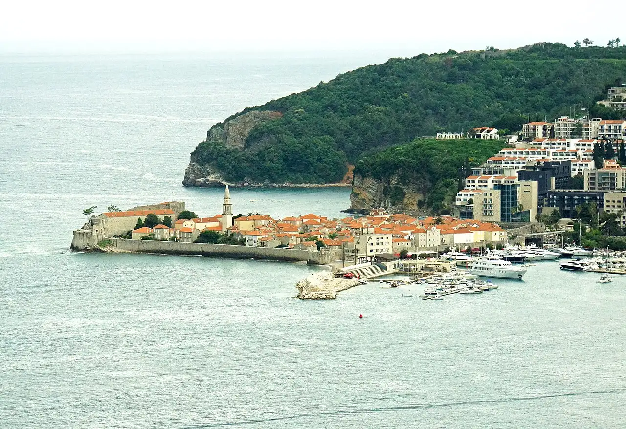
Photo: Dennis G. Jarvis / Wikimedia Commons, CC BY-SA 2.0 -
Sveti Stefan
71 km from the startstop ≈60 min
The islet that appears on every Montenegro postcard - a former fishing village turned private resort on a slim causeway. The island is closed to non-guests, but the viewpoint above the road is free and the beaches either side are open.
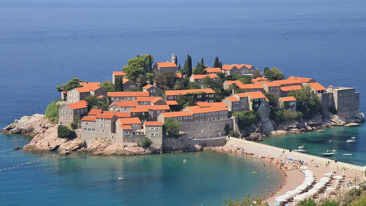
Photo: Marcin Konsek / Wikimedia Commons, CC BY-SA 4.0 -
Bar & Stari Bar
100 km from the startstop ≈180 min
Modern Bar is the main port of Montenegro, with summer ferries to Italy. The reason to stop is Stari Bar, 5 km inland: a ruined hill town nobody has lived in for a century, and the Old Olive Tree at Mirovica, reputedly over 2,000 years old.
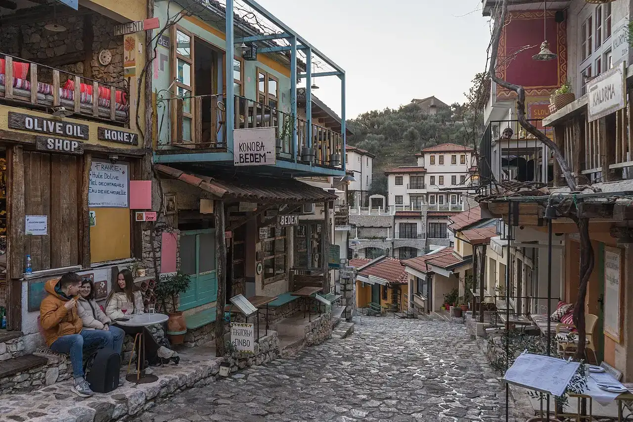
Photo: Alexkom000 / Wikimedia Commons, CC BY 4.0 -
Ulcinj & Velika Plaža
125 km from the startstop ≈240 min
The southernmost town, closest to Albania, with a walled old town on the hill and a strong Ottoman-Albanian character. South of it runs Velika Plaža - about 12-13 km of sand, the longest beach in the country and the top Adriatic kiteboarding spot - ending at the Bojana river and Ada Bojana.
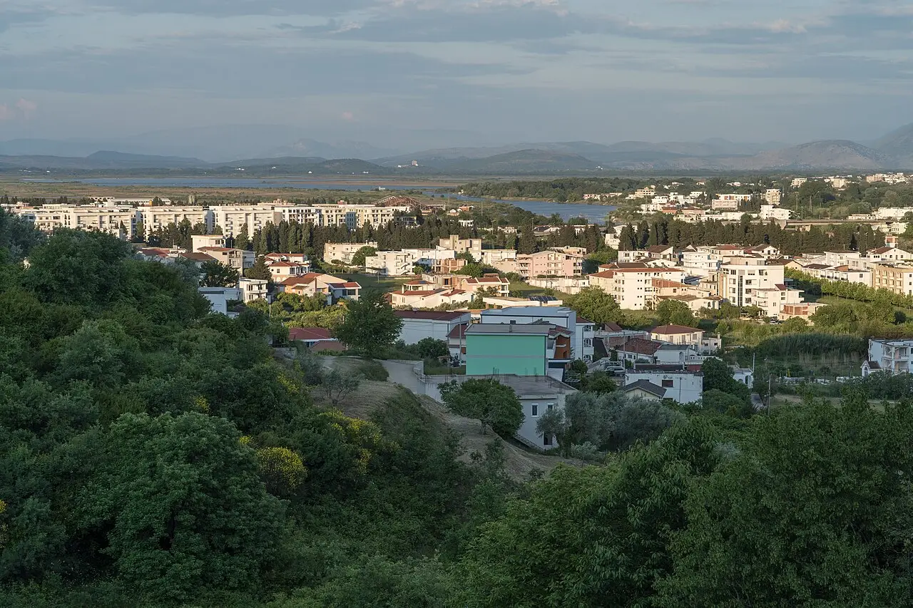
Photo: Alexkom000 / Wikimedia Commons, CC BY 4.0
Route map
The map with stops loads on click - to keep the page lightweight.
The map didn’t load. Check your connection and refresh the page.