
Durmitor Ring Road 2026: 76 km Loop, Time, Season & Car
76 km loop from Žabljak (83 km with Ćurevac), about 4 hours with stops. Best May-October, usually shut in winter. Car, camper and park ticket tips.
The Durmitor Ring is a 76 km loop (83 km with the side trip to the Ćurevac viewpoint) that starts and ends in Žabljak and circles the Durmitor massif on a narrow, fully paved mountain road. Montenegro’s tourist board budgets about four hours for it, driving plus short walks. The road tops out at about 1,950 m on the Štuoc saddle, which is higher than the better-known Sedlo pass (1,907 m).
Open as of 24 September 2026: the whole loop has been passable since 21 May 2026, when the snow was cleared off the Sedlo section, and the September road reports of AMSCG, Montenegro’s motoring association, show no restrictions on it. There’s no fixed closing date. The official brochure says the ring is usually shut in winter and recommends May to October, so on an autumn trip check the AMSCG road report that morning or call its roadside line, 19807. Tara Bridge closed until 26 October 2026: the side trip there is off until it reopens, as the bridge is shut to cars and pedestrians for reconstruction.
The recommended direction is anticlockwise from Žabljak: Ćurevac and the rim of the Tara canyon first, then the Štuoc saddle, Mala Crna Gora and the Sušica canyon, lunch in Trsa, and the climb over Sedlo back to town. Žabljak’s tourist board gives a practical reason: its izi.travel audio guide only works if you drive that way. The loop crosses Durmitor National Park and the Piva Nature Park.
When it’s open, what to drive and what to pay
The season. The ring opens when its high sections are cleared of snow, and the two sides don’t always open together: in 2026 the Nedajno and Mala Crna Gora side was passable first, and the Pišče, Todorov Do and Sedlo stretch followed on 21 May, according to the Piva Nature Park. After the thaw or heavy rain, watch for rockfall and damaged tarmac, above all in the Sušica canyon.
The time. The tourist board’s four hours covers the driving and short walks. A route planner gives just under two hours of pure driving for the loop, but on a road this narrow, with oncoming cars and photo stops, allow closer to three. Add about an hour for the walk up Ćurevac and another for the Black Lake, and the ring fills a day.
The car. Any ordinary car will do. The road is paved all the way, but it’s narrow and twisting, and on some bends you’ll have to pull in and let an oncoming car pass, so a compact or mid-size car is far easier than a big SUV; our guide to renting a car in Montenegro covers what to book. The official brochure says the route isn’t suitable for camper vans 7 m or longer, 2.30 m or wider, or 2.90 m or higher. Drivers of smaller campers should be at home on narrow mountain roads, and the tourist board suggests they go round clockwise.
The park ticket. The ring crosses Durmitor National Park, which charges €5 per person per day; children up to 15 go free. Rangers sell tickets at the car parks along the road (the brochure names Sedlo, Ćurevac and Prutaš), or you can buy one online from the park’s ticket site. One ticket covers the whole day, Black Lake visitor centre and trails included. No car? The park’s price list includes its own organised Durmitor Ring tour at €20 a person by van or €30 by jeep, park entry included; check with the park that it’s running on your dates.
Do it as a day trip or an overnight?
You can drive the whole ring in a day from Žabljak, and most people do. The smarter play is to sleep in Žabljak the night before, start early and keep the afternoon for the Black Lake or a rafting trip. Trsa, halfway round, also has beds if you’d rather split the loop. For which part of Žabljak to pick, see the guide to where to stay in Žabljak.
| Plan | What you fit in | Where you sleep |
|---|---|---|
| Half day | The ring drive with the main viewpoints, no walks | Passing through |
| Full day | Ring + the Black Lake loop + the Ćurevac walk | Žabljak |
| Two days | + Tara rafting or a Durmitor hike (Black Lake to the higher lakes) | Žabljak x2 |
The budget from €40 is a rough daily floor per person up here in summer: a simple room in Žabljak, fuel, the park ticket and a cheap meal.
Start in Žabljak: fuel up first
Žabljak sits at 1,456 m, which makes it the highest town in the Balkans, and it’s the hinge of the whole trip. Do one thing before you set off: fill the tank. There’s no petrol station anywhere on the ring, and the nearest alternatives, in Šavnik and Plužine, are both off the loop. Take water and something to eat as well: Nedajno has a place for a snack and Trsa is the lunch stop, but there are long empty stretches in between.
The town itself won’t detain you long. It’s a scatter of ski hotels, a bus station and a few grill restaurants around a crossroads, with brown signs pointing off to Jezera (the lakes), the Savin Kuk ski lift and Pljevlja. It’s a base, not a sight.
Black Lake: the walk everyone does
The Black Lake (Crno jezero) isn’t on the ring itself, but it’s within walking distance of the centre and nobody skips it. It’s actually two glacial lakes joined by a narrow channel, the Big and the Small Lake, lying at 1,416 m in pine forest beneath the grey bulk of Meded and, further back, Savin Kuk. The lake is inside the national park, so the same day ticket covers it.
The educational trail around the lake is about 3.6 km, flat and well made, and the park reckons on about an hour. Go clockwise and the far, forested side is quieter and shadier; the path on the Small Lake side stays damp and can be slippery even in summer, so decent shoes help. Serious Durmitor hikes to the higher lakes start here too, but the shore loop alone is reason enough to come.
The Đurđevića Tara Bridge
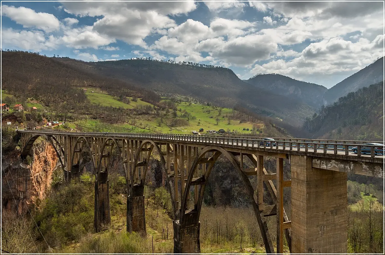
Closed until 26 October 2026, 12:00. The bridge is shut to all traffic, pedestrians included, for reconstruction. Montenegro’s Transport Administration closed it on 10 August and set noon on 26 October as the reopening; on 23 September it said the work was running about ten days ahead, so it may open around 10 October if the weather allows. Through traffic between Žabljak and Pljevlja uses the Vrulja-Mijakovići detour. Until it reopens you can’t walk out on the deck, so check the AMSCG report before you drive 23 km for the view.
Once it’s open again, it’s worth the drive. Finished in 1940, the bridge is a 365 m concrete arch carrying the road 172 m above the river on five arches, the largest spanning 116 m, and when it was completed it was the biggest reinforced-concrete road bridge in Europe. There’s a sad story to it: the engineer Lazar Jauković, who helped build it, blew up one of its arches in 1942 and was shot on the bridge by the Italians. A monument to him stands near the bridge.
The canyon around it is the Tara’s adventure hub. A zip-line crosses the gorge, and the Tara is Montenegro’s rafting river; the national park rates 1 July to 15 September as the safest window, when the water level suits it. If there’s one add-on worth building a second day around, it’s rafting.
Ćurevac: the biggest view on the ring
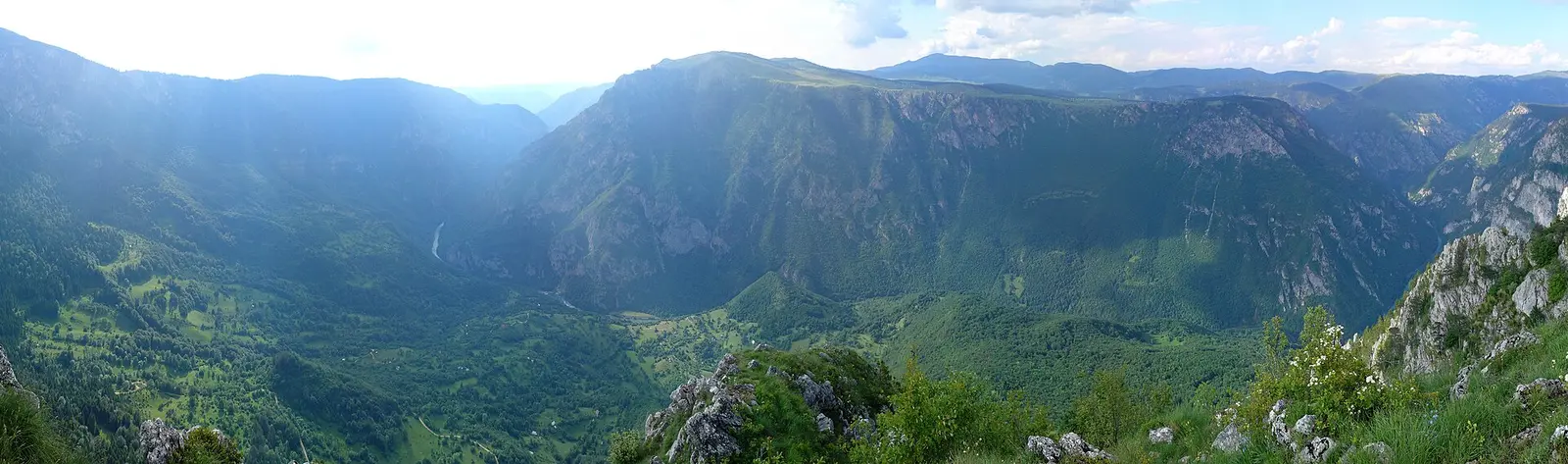
Back on the loop, don’t miss the turn for Ćurevac: it’s the detour that turns 76 km into 83. A paved side road runs 3.5 km towards Tepca and Nadgora to a car park with a park ticket point, and the Tara canyon is already in view from there. The real payoff is the top: a rocky 1.1 km path, narrow in places and right along the edge of the gorge, climbs to the 1,625 m summit and a 360-degree panorama over the river and the village of Tepca. Allow about an hour there and back, keep children close, and don’t rush it in or after rain, when the rock gets slippery.
Štuoc, Mala Crna Gora and the Piva side
Past the Ćurevac turn the road climbs through Bosača, a hamlet at about 1,600 m that had the area’s first chairlift, and then crosses the saddle between Veliki (2,104 m) and Mali Štuoc (1,953 m). At 1,952 m, it’s the highest point of the whole ring. From there the road runs right along the rim of the Tara canyon before it winds down through thick forest.
Mala Crna Gora, “Little Montenegro”, is a handful of houses, and it’s cut off by snow for months each winter. Just beyond it the Sušica canyon opens up, 15 km long and up to 700 m deep; the slopes are sheer, so keep back from the edge. Lake Sušica lies on the valley floor and dries out completely in summer. After Nedajno, the snack stop, the road runs through the Milogora forest to Trsa, the halfway point and the brochure’s pick for lunch, and across the high meadows of Pišče, where the Piva mountains, Bioč and Maglić, fill the skyline.
From Trsa the R-16 also drops west to Plužine and the turquoise Piva reservoir, a detour worth adding if you’re leaving the mountains that way; see Piva Lake and Canyon.
Sedlo pass and the run back to Žabljak
From Pišče the road climbs hard past the rock field of Pirni Do to the Todorov Do valley at 1,800 m, with Prutaš (2,393 m) at its head. Then comes Sedlo, at 1,907 m, on the R-16 (numbered P14 on older maps): a bare karst saddle under the jagged ridge of Sedlena Greda (2,227 m), the “Saddle of the Gods”, with views over the surrounding lakes and the Šljeme peaks. It’s one of the busiest viewpoints on the ring and the trailhead for Bobotov Kuk, Durmitor’s highest peak at 2,523 m.
Sedlo is often billed as Montenegro’s highest paved pass, yet the official brochure puts the Štuoc saddle, on this same loop, 45 m higher. Stop here for the view rather than the record. From the pass the road drops through the Pošćenska valley and its small lakes, then joins the main road from Šavnik for the last run into Žabljak, with Savin Kuk (2,313 m) ahead.
Driving the ring: what to know
- Signs. The ring is signposted both ways with brown “Panoramic Roads” signs carrying the number 2.
- Daylight and layers. Drive it in daylight, and pack a warm layer and sunscreen: the brochure warns that mountain weather here can differ sharply from the weather elsewhere in Montenegro.
- Cash. Keep some notes for village cafés; don’t count on cards in the small villages.
- Help. Roadside assistance (AMSCG) is 19807, and the emergency number is 112.
Nearby / read also
- Durmitor National Park - the wider park, its peaks and lakes.
- Montenegro road trip - the full coast-to-mountains loop this ring belongs to.
- Montenegro coastal road trip - the sea half, Herceg Novi to Ulcinj.
- Renting a car in Montenegro - pickup points, roads and costs.
- Best time to visit Montenegro - when the mountain roads are clear.
- All routes in Montenegro - more driving ideas.
Route day by day
- Days on the road
- 1
- Distance
- ≈76 km
- Budget from
- 40 EUR
- Best season
- May, June, July, August, September, October
The route at a glance
-
Žabljak
Route startstop ≈120 min
Start and finish of the signed loop, 1,456 m up. Fuel, water and snacks before you set off.
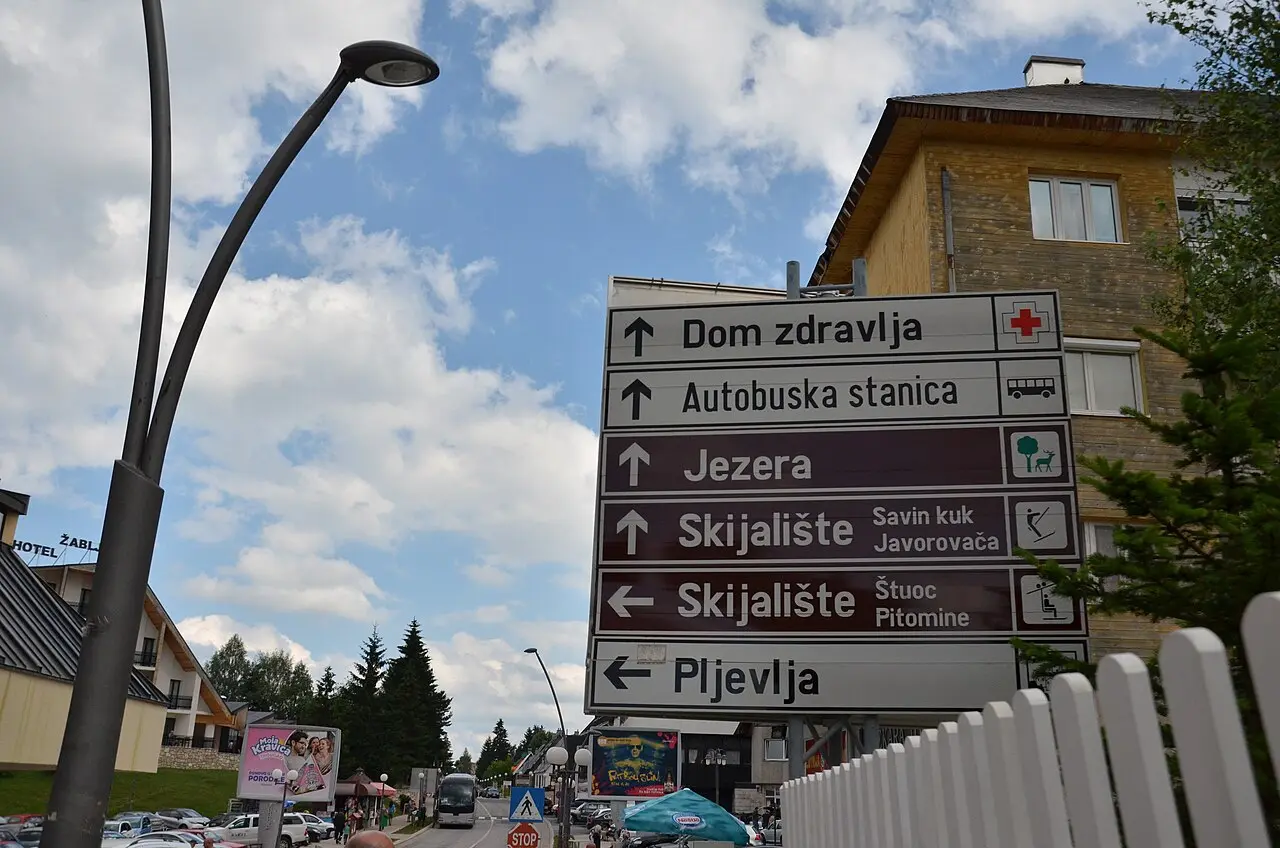
Photo: Rakoon / Wikimedia Commons, CC0 ( source) -
Black Lake (Crno jezero)
3 km from the startstop ≈120 min
Off the ring but walkable from the centre: a flat 3.6 km trail round two joined glacial lakes, about an hour, on the park day ticket.
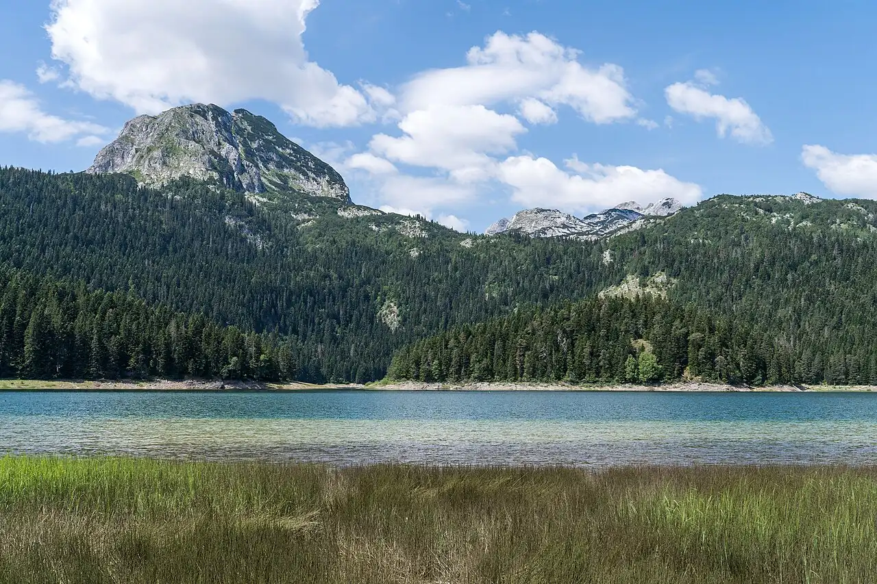
Photo: Alexkom000 / Wikimedia Commons, CC BY 4.0 ( source) -
Ćurevac viewpoint
8 km from the startstop ≈60 min
A turn early on the loop, 4 km from the centre: 3.5 km of side road by car, then about an hour on foot, there and back, to the 1,625 m top above the Tara canyon.
Photo: geerge / Wikimedia Commons, CC BY 3.0 ( source) -
Trsa & the Piva side
38 km from the startstop ≈60 min
Halfway round and the lunch stop, after Mala Crna Gora, the Sušica canyon and Nedajno; the road west to Plužine and the Piva reservoir starts here.
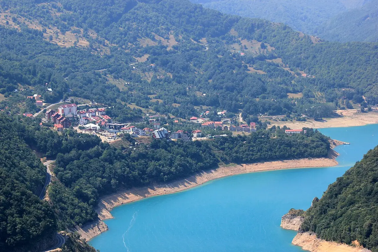
Photo: Julian Nyča / Wikimedia Commons, CC BY-SA 4.0 ( source) -
Sedlo Pass (R-16, ex-P14)
62 km from the startstop ≈60 min
The 1,907 m saddle under Sedlena Greda, trailhead for Bobotov Kuk and the last big viewpoint before Žabljak.
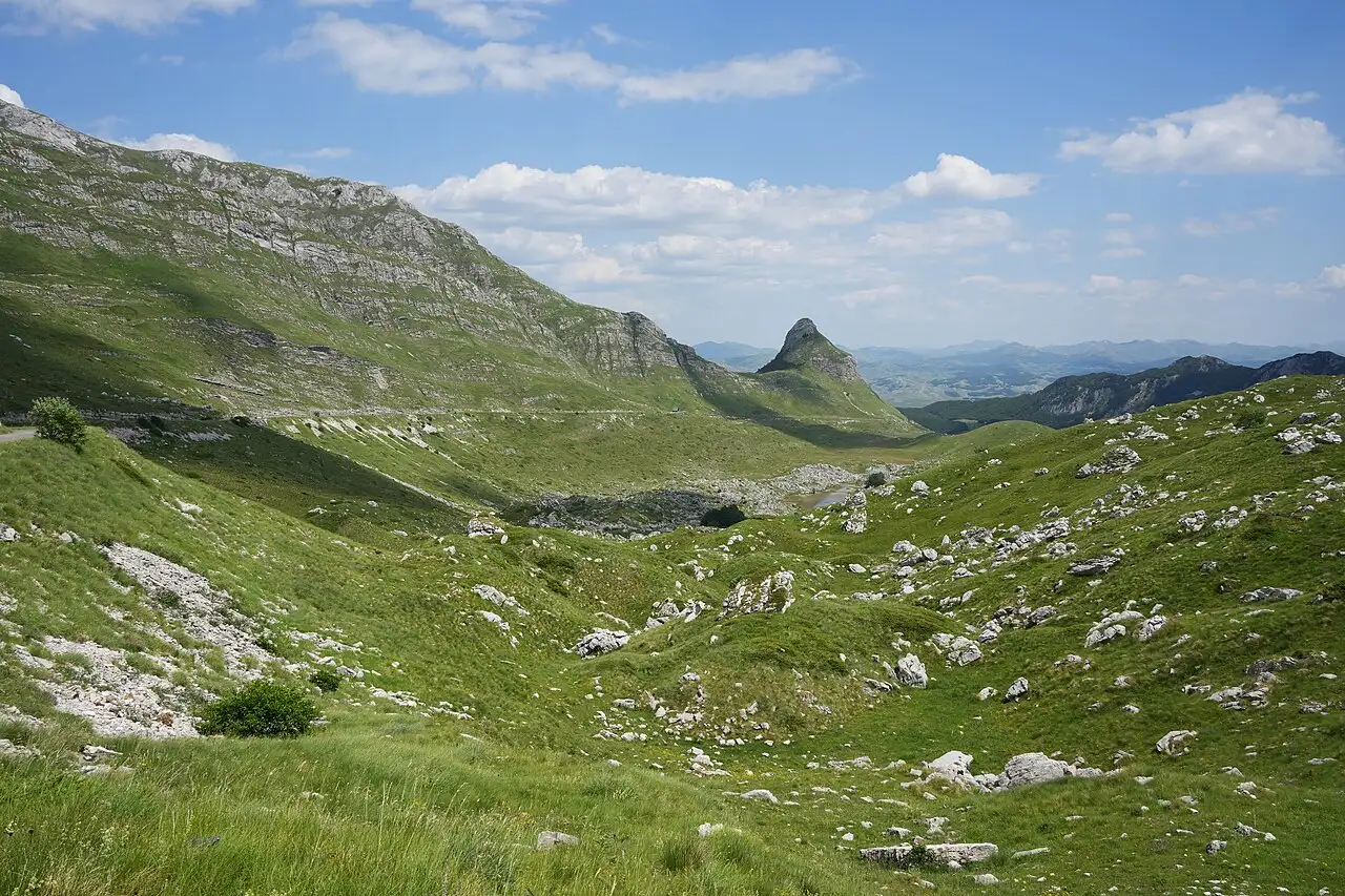
Photo: Ingo Mehling / Wikimedia Commons, CC BY-SA 4.0 ( source) -
Đurđevića Tara Bridge (side trip)
23 km from the startstop ≈60 min
Off the ring, 23 km east of Žabljak. Closed to cars and pedestrians until 26 October 2026, 12:00, so check the AMSCG road report before you drive out.
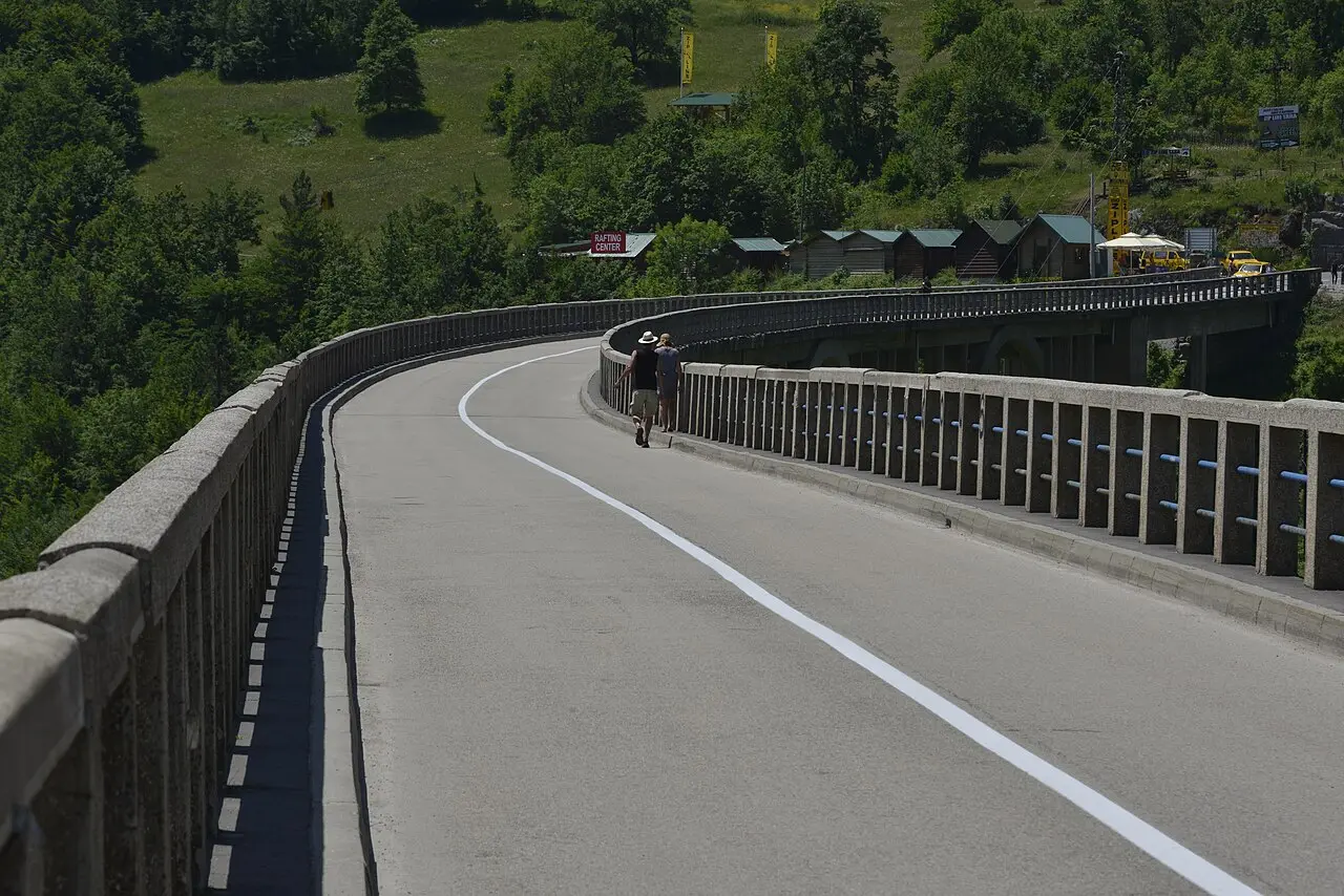
Photo: Miomir Magdevski / Wikimedia Commons, CC BY-SA 4.0 ( source)
Route map
The map with stops loads on click - to keep the page lightweight.
The map didn’t load. Check your connection and refresh the page.