
Biogradska Gora National Park: Lake, Forest & Hikes
Biogradska Gora guide: the lake loop, one of Europe’s last primeval forests, Bjelasica hikes, 2026 park fees and how to get there from Kolasin.
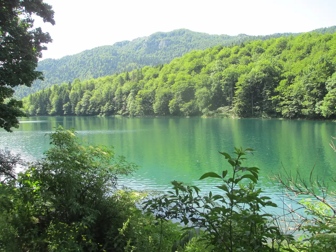
Biogradska Gora is Montenegro’s oldest national park, built around a glacial lake and one of the last primeval forests left in Europe, high in the Bjelasica mountains in the country’s north. Most people come for the easy hour-long loop around Lake Biogradsko and the walk through 400-year-old trees, then decide whether to push on into the mountains behind it. The park is about 20 km from Kolasin and roughly 80 km and 1.5 hours from Podgorica, entry is €4 per person, and the season runs from about May to October. The lake loop is the easy part; what decides your day is when you come and how far past the near shore you’re willing to walk.
Why Biogradska Gora is worth it
The draw here’s not a jagged skyline - it’s an ancient forest and a mirror-still lake, which makes this a gentler, greener day than the high peaks of nearby Durmitor. At the park’s heart sits roughly 1,600 hectares of virgin forest inside a protected area of 5,650 hectares: trees that have never been logged, some over 45 m tall and up to four centuries old. It’s often described as one of the last three primeval forests in Europe, and walking under that canopy - dim, mossy, silent apart from birds - is the reason to come.
The park’s history is part of the appeal. The forest was set aside in 1878, when the local Morača and Rovca tribes gave it to Montenegro’s Prince Nikola as a protected reserve - the Knjažev zabran, “the prince’s ban” - which makes it one of the oldest protected areas in the region. It was formally proclaimed a national park in 1952, and that long line of protection is why the woodland is so intact, and why the biodiversity is dense: sources count around 2,000 plant species, 200 kinds of bird and healthy numbers of bears, wolves and deer in the wider park.
Lake Biogradsko and the shore loop
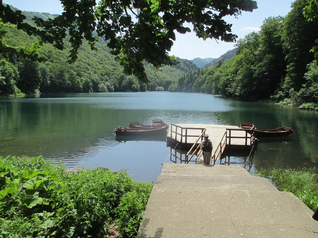
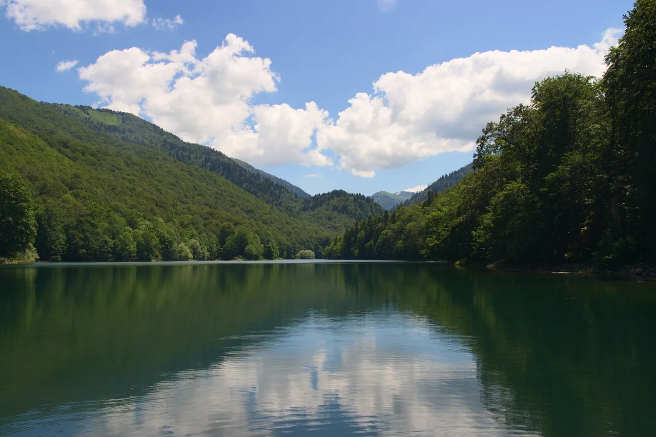
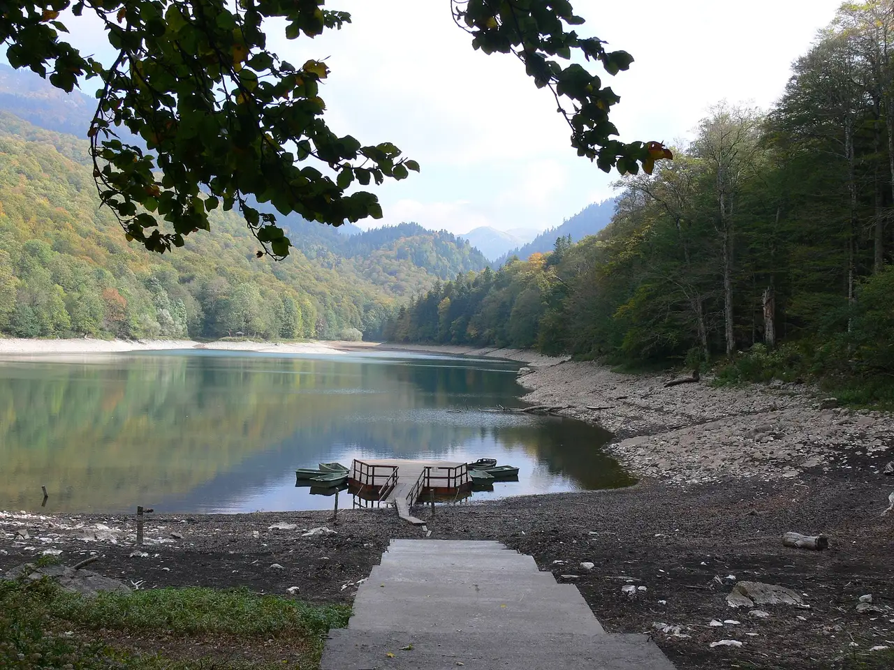
If you do one thing here, walk the lake. Lake Biogradsko is a glacial lake at the valley floor, the largest and most accessible of the park’s mountain lakes. It sits at 1,094 m, covers a little over 0.2 square kilometres and drops to about 12 m at its deepest - small enough to walk right around, big enough to hold trout and a mirror reflection on a calm morning. An easy 3.5 km loop follows the shoreline: flat, well-trodden, lined with benches and information boards, and comfortably done in about an hour. It’s the walk that works for families, older visitors and anyone who wants the forest without a climb.
The lake shrinks as the season goes on: by August the far end can be a broad grassy shallows rather than open water, still beautiful, just not the spring mirror. Crowds are as predictable as the water level, gathering on the near shore by the entrance and the restaurant; keep walking to the far side and you’ll usually have the reflections and the old trees mostly to yourself. To be out on the water, you can hire a rowing boat for €10 an hour or a kayak for €3-5, the easiest way to escape the shoreline traffic for a while.
Walking in the primeval forest
The forest is the real headline, and it rewards slowing down. The core is dominated by beech and spruce, with silver fir mixed in, and the oldest trees are genuine giants - over 45 m tall and up to 150 cm across. One silver fir here, named Doria, was measured at 59.7 m, recorded as the tallest and thickest European silver fir known. Because the wood has never been cut, it works as a whole system: fallen trunks are left where they drop, rotting slowly back into the soil and seeding the next generation, so the floor is a tangle of moss, deadwood and saplings rather than a tidy plantation.
That is easy to miss if you only circle the lake. A marked forest trail branches off the shore path with information boards, and the short detour into the old growth is the part most people remember - a few minutes in from the water the trees are noticeably taller, the light greener and the quiet deeper. Go gently, stay on the marked path, and take nothing: the whole point of a virgin forest is that it’s left alone.
Hiking beyond the lake
The lake loop is the appetiser; the mountains behind it are the main course. There are six marked trails in the park and the Bjelasica range, from short forest walks to full-day ascents, and the terrain is grassier and more rounded than Durmitor’s rock - good for walkers who want distance without scrambling.
A popular next step up is the trail from Lake Biograd to Dolovi, roughly 8 km and about two hours one way at a medium grade, climbing out of the forest into open pasture. From the high ground the Bjelasica peaks open up: Crna Glava at 2,139 m is the range’s highest, with Zekova Glava (2,117 m) and Bendovac (1,774 m) nearby, and fit walkers link several over a long day or spread the range across two or three days of hut-to-hut walking. The trails are best from about June to September, once the snow has cleared; outside that window paths hold snow and the weather closes in fast at altitude. If you want to go higher without navigating alone, the park offers guided hikes (€40 for four hours, €80 for eight) - useful given how quickly mountain weather turns here.
Fees, camping and what to bring
Costs are low and paid on the spot. On the official price list of Nacionalni parkovi Crne Gore, checked 1 August 2026, park entry is €4 per person per day and children under 15 go free in all five national parks; it’s collected at the entrance by the lake during the staffed season, and parking by the lake is free. On top of that, a rowing boat is €10 an hour, a kayak €3 an hour single or €5 for a two-seater, a bicycle €3 an hour or €8 a day, and a daily fishing permit €20. If you want to stay, a tent pitch is €3 a day and the kept camping ground at Kraljevo kolo is €20 a day - a rare chance to sleep inside a national park and have the water to yourself at dawn, before the day-trippers arrive.
Bring cash: card machines are not reliable this far into the mountains, and the fees are collected by hand. And don’t underestimate the altitude - the lake sits high, mornings are cool even in July, and the weather can swing quickly, so pack a layer and proper shoes even for the flat loop.
Getting there and combining it
Biogradska Gora sits in the north between the Tara and Lim valleys, and the easy gateway is Kolasin, the small mountain and ski town about 20 km away. Kolasin itself makes a handy base, with a cluster of hotels and restaurants and a ski lift in winter, if you would rather not day-trip all the way from the coast. From Podgorica it’s roughly 80 km and about an hour and a half on the E65/E80; the turn-off is a blue bridge over the Tara signed for the national park, from where a short park road climbs to the lake. A car is by far the easiest way to reach it, since public transport drops you on the main road well short of the entrance; our guide to renting a car in Montenegro covers costs and pickup points, and getting around Montenegro explains how the north connects.
If you would rather not drive the mountain roads, organised day trips and guided hikes run from Kolasin and from the coast. Either way, the park pairs naturally with the rest of the north: it’s an easy add-on to a trip built around Durmitor National Park and the Tara Canyon, and many visitors string all three together. For how it fits a wider route, our Montenegro travel guide maps the country region by region, and the best time to visit guide explains why the mountain season runs later and shorter than the coast.
Nearby / read also
To see where this forest park sits against Durmitor, Lovćen, Skadar and Prokletije, use the national parks compared guide.
- Durmitor National Park - the north’s other, higher park, an hour or so on.
- Tara Canyon rafting - the deepest canyon in Europe, nearby.
- Lovćen National Park - the mountain park above Kotor and Cetinje.
- Getting around Montenegro
- Best time to visit Montenegro
- Renting a car in Montenegro
- Things to do in Montenegro - the country-level highlights this park adds to.
On the map
The map loads on click - to keep the page lightweight.
The map didn’t load. Check your connection and refresh the page.
Admission and opening hours
- Admission price
- Park entry €4 per person per day (children under 15 free); rowing boat €10/h, kayak €3-5/h
Official price list of Nacionalni parkovi Crne Gore (nparkovi.me). Fees are collected at the entrance by the lake in season and change year to year - bring cash and confirm the current rate on the day. Parking by the lake is free.
Details checked: August 1, 2026
Distance ≈80 km · ≈1.5 h
- Podgorica ≈80 km · ≈1.5 h
Read also

What to see · 10 min read
Hiking Bobotov Kuk: Durmitor Highest Peak
Verified · September 4, 2026Bobotov Kuk hike at 2,523 m: Sedlo (~10 km RT) vs Lokvice from Black Lake, €5 park fee, cables, season and early-start tips.

What to see · 10 min read
Swimming in the Bay of Kotor: Beaches & Lidos
Updated · August 31, 2026Can you swim in Kotor? Yes - on Dobrota pontoons, Morinj and small Boka shores. Water quality, season and what to expect.

What to see · 11 min read
Rent a Boat in Kotor Bay: No Licence Needed
Updated · September 5, 2026Private boat rental in Kotor Bay 2026: skippered hire from €90/h, bareboat prices, licence rules, speed limits and where boats leave from.

What to see · 9 min read
Piva Lake & Canyon: Montenegro's Emerald North
Updated · August 27, 2026Piva Lake guide: the 45 km emerald reservoir, Mratinje Dam, boat trips from Plužine, the relocated Piva Monastery and how to pair it with Durmitor.