
Lovćen National Park: Njegoš Mausoleum Fees & Hours
Lovćen National Park: €3 entry, €8 for the Njegoš Mausoleum, open 09:00-18:00. The 461 steps, Kotor serpentine, cable car and the Njeguši ham stop.
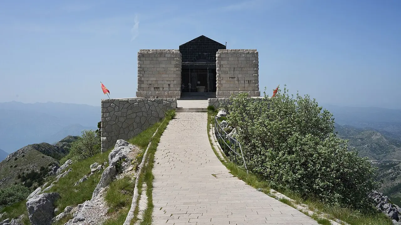
Lovćen is the mountain you see from the coast: the dark, forested massif that rises straight up behind the Bay of Kotor and, most people will tell you, gave Montenegro its name - Crna Gora, the “black mountain.” Park entry is €3 a person, the Njegoš Mausoleum takes a separate €8 ticket, and the mausoleum keeps to 09:00-18:00 daily from mid-April to mid-November. It sits on a terrace at 1,657 m, reached by 461 steps, with a view over what feels like half the country. Getting up is half the experience: either the white-knuckle Kotor serpentine or the cable car that now spares you the hairpins. This is a car or organised-tour trip, not a bus one, and it pairs naturally with Cetinje just down the far side.
Why Lovćen is worth the climb
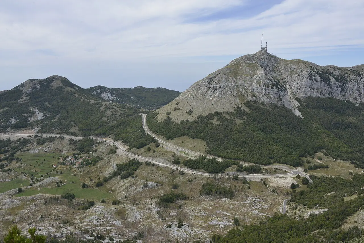
Lovćen sits inland from Kotor, a compact limestone range that separates the coast from the old royal heartland around Cetinje. It became a national park in 1952, and it’s not a huge one - the appeal is concentrated rather than sprawling. Two summits define it: Štirovnik at 1,749 m, the highest point, and Jezerski vrh at 1,657 m, the slightly lower peak that carries the mausoleum and does most of the sightseeing work.
The reason to come is partly the symbolism and partly the sheer position. Montenegrins treat this mountain as the spiritual core of the country, and standing on the terrace above the tomb, with the Adriatic on one side and the grey karst plateau of the interior on the other, you understand why. It’s one of the few places where Montenegro’s two halves - the Mediterranean coast and the wild inland mountains - line up in a single view. If you’ve already done the beaches and the old towns and want to see the country whole, this is the spot.
The Njegoš Mausoleum: 461 steps to the tomb
The mausoleum is the headline sight, and it takes some effort to reach even after you’ve parked. From the Jezerski vrh car park a tunnel and 461 stone steps climb the last stretch to the summit - allow 20 to 30 minutes at a steady pace, more if the altitude or the cold slows you down. It’s not a hard climb, but it’s a climb, so leave the flip-flops in the car and bring a layer; it can be fifteen degrees cooler and a good deal windier up here than on the beach you left an hour ago.
At the top sits the tomb of Petar II Petrović-Njegoš (1813-1851), and it helps to know who he was, because the reverence up here makes no sense otherwise. Njegoš was that rare thing, a ruler who was also his nation’s greatest writer: a prince-bishop who governed Montenegro and, in the same short life, wrote Gorski vijenac (The Mountain Wreath), still the cornerstone of Montenegrin literature. He died of tuberculosis at 37 and asked to be buried on Lovćen, on the mountain he could see from Cetinje.
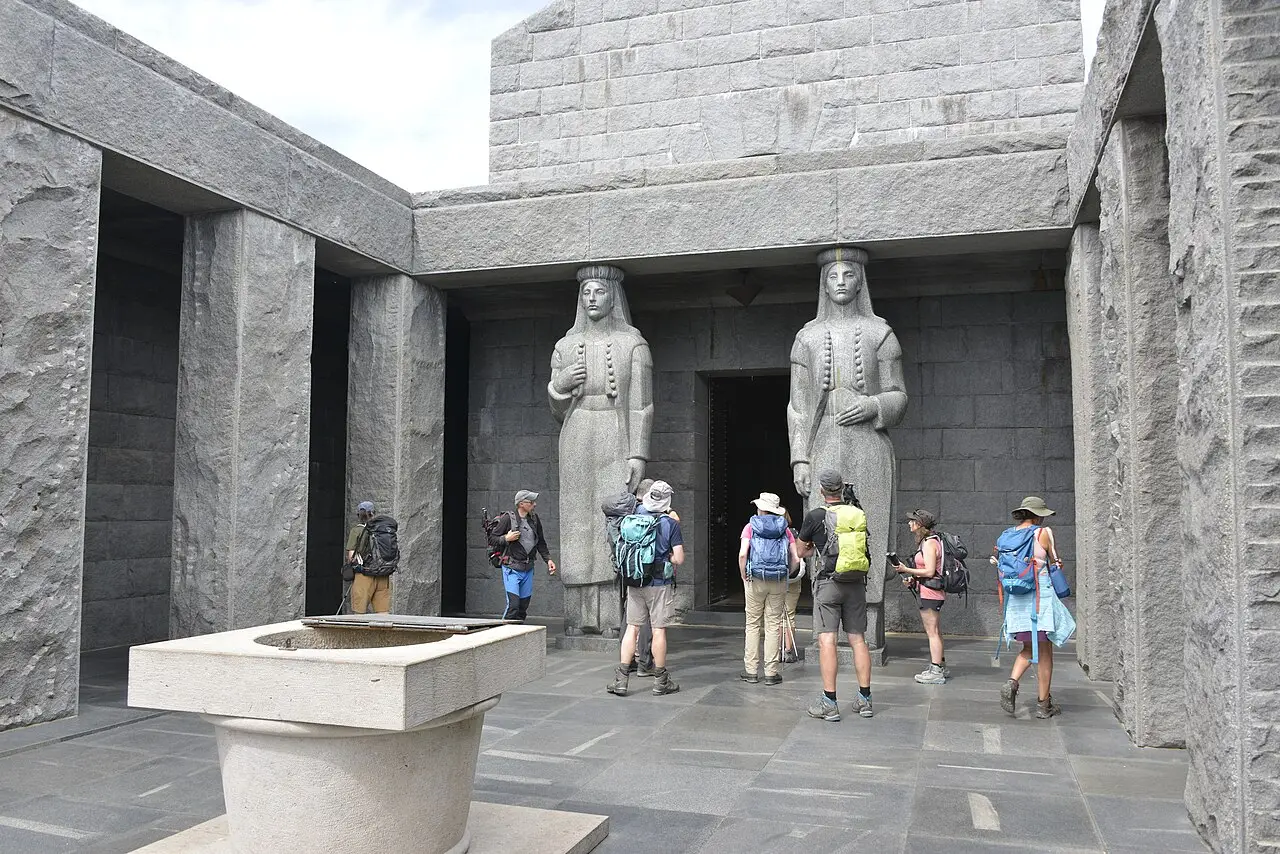
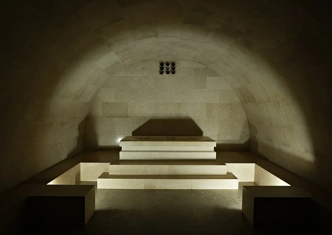
The current mausoleum, which replaced a small chapel Njegoš himself had built, was designed by the sculptor Ivan Meštrović and completed in 1974, twelve years after Meštrović’s death. Inside is a severe, powerful octagonal chamber: a gold-mosaic ceiling, a large seated granite statue of Njegoš beneath a canopy, and his black granite sarcophagus below. Two granite caryatids - women in Montenegrin folk dress - stand guard on the approach. The building was controversial when it went up, replacing an older chapel on a site loaded with meaning, and you can still find Montenegrins with firm opinions about it. Go, and form your own.
The view from the terrace
Behind the tomb, a circular terrace is the real reward, and on a clear day it’s genuinely one of the great panoramas in the Balkans. Laid out below you, more or less all at once, are the Bay of Kotor and the open Adriatic (locals will point out the Italian coast on the clearest days), the pale sheet of Lake Skadar to the southeast, the distant peaks of Durmitor to the north, and the karst plain around Cetinje directly beneath. It earns the cliché that you can see much of Montenegro from a single spot - which, for a country this small and this varied, is close to true.
The catch is cloud. Lovćen makes its own weather, and a summit that’s crystalline at nine can be sitting inside a grey cloud by noon, or the other way around. If the forecast is marginal, go early, and don’t be surprised if the coast is sunny while the mountain is socked in. That variability is exactly why the terrace view feels earned when you get it.
Driving up: the Kotor serpentine (and the cable car)
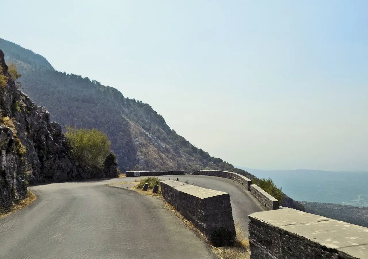
Half the drama of Lovćen is the road to it. The classic approach from Kotor is the old serpentine - a stack of roughly 25 numbered hairpins completed back in 1884 that hauls you from sea level toward Njeguši in about eight kilometres of near-continuous turning. It’s spectacular, with the whole bay dropping away beneath each bend, and it’s not for everyone: the lane is narrow, some corners are blind, and there are long drops on the outside. Drive it in daylight, in a small car, going up if you can (uphill traffic hugs the inside), and give way early. If hairpins make your passengers green, this isn’t the route for them.
The gentler option now exists. Our full Kotor cable car guide covers tickets and hours in detail, but in short: the Kotor-Lovćen cable car has run since 14 August 2023 and climbs from the Dub station, about 4 km southwest of Kotor’s old town, up to the mountain in 11 minutes for €25 return (adult, checked 2 August 2026 - prices are seasonal, confirm before you go), sparing you the serpentine entirely. Worth knowing: the top station sits at Kuk, 1,348 m, near Ivanova Korita on the park’s edge, not at the mausoleum itself, so you still have 6 km of mountain road to Jezerski vrh by onward transport - check current options at the top station.
The third way is to let someone else drive. Organised day tours from Kotor and Budva bundle Lovćen with Cetinje and the Njeguši ham stop, take the mountain roads off your hands, and are the stress-free choice in high summer. If you would rather roam on your own schedule, our guide to renting a car in Montenegro covers the practicalities of driving here.
| Way up | Time | Rough cost | Best for |
|---|---|---|---|
| Kotor serpentine (drive) | ~40 min from Kotor | Fuel + park entry | Confident mountain drivers |
| Cable car + onward hop | ~11 min ride | €25 return + transfer | Skipping the hairpins |
| Organised day tour | Half to full day | Per-person tour price | No driving, Cetinje included |
Njeguši and the ham stop
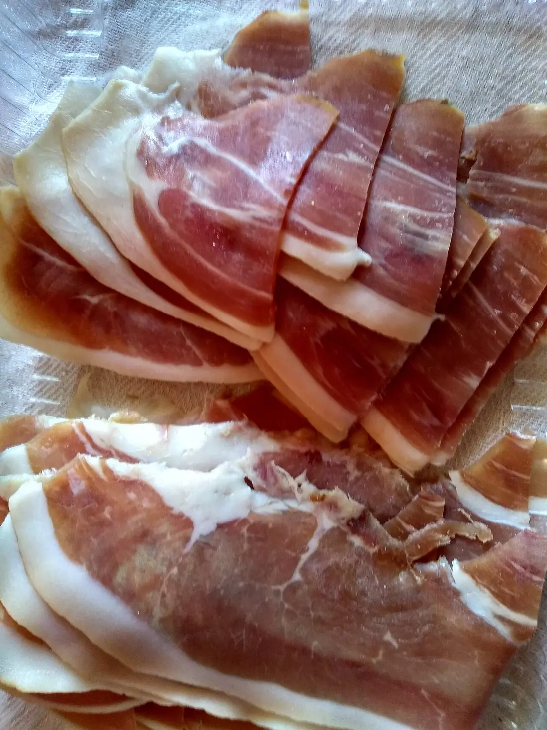
If you drive, don’t blow straight through Njeguši, the village at around 1,000 m on the Kotor side of the park. It’s the ancestral home of the Petrović dynasty that produced Njegoš, but the reason most people stop is edible: Njeguši is the home of Montenegro’s best-known pršut (air-dried, lightly smoked prosciutto) and its firm mountain cheese, both cured in the dry, cold air that funnels through the pass. Family konobas along the road serve a plate of ham, cheese, olives and bread with a shot of lozovača for a few euros - a better lunch than anything waiting at the summit, where food is limited. One thing worth knowing before you buy your mausoleum ticket: the same €8 admission also covers Njegoš’s birth house here in the village, so if pršut already brought you to Njeguši, it is worth the short detour. It’s the single most rewarding non-view thing you can do up here.
Hiking and Ivanova Korita
Beyond the mausoleum, Lovćen is quietly good walking country, and most visitors never see it. Ivanova Korita, a green hollow at about 1,250 m, is the park’s recreation hub, with marked trails, a scatter of lodging and shade under old beech woods - a cool contrast to the coast in July. From here a popular loop of around three hours climbs toward Babina Glava for views over the Budva and Tivat rivieras, and stronger walkers can take on Štirovnik (1,749 m), the park’s true summit. None of this is technical, but you’re at altitude, the weather turns fast, and shade is patchy above the tree line, so carry water, a layer and sun cover, and start early in summer.
Fees, hours and practical tips
A few things save hassle at the top. The national park entry fee is €3 per person (the park administration’s own price list, nparkovi.me), and the Njegoš Mausoleum takes a separate €8 ticket - which also covers Njegoš’s birth house down in Njeguši - so figure on €11 total per adult (checked 5 August 2026); students pay €4 for the mausoleum. Rates can still move year to year, so bring cash rather than trust a figure online. The mausoleum itself keeps to 09:00-18:00 daily, from 15 April to 15 November (National Museum of Montenegro, which runs the site), and is closed from 16 November to 14 April, when snow can shut the road and the steps anyway. Outside that window, check conditions before you drive up.
Two more honest caveats. This is a mountain, so pack a layer and proper shoes even on a hot coastal day - the summit wind bites. And time it for weather over crowds: a clear morning here’s worth reshuffling your week for, while a cloudy one leaves you climbing 461 steps into a grey blank. For how the mountain seasons differ from the coast, our best time to visit Montenegro guide breaks it down.
Nearby / read also
- National parks of Montenegro compared - Lovćen versus the other four, and which combos fit a coast week.
- Best day trips from Kotor - where Lovćen fits among the classic half-day runs.
- Cetinje travel guide - the old royal capital just down the mountain, the natural pairing.
- Durmitor National Park - the bigger, wilder mountain park in the north.
- Renting a car in Montenegro - what to know before you take on the serpentine.
- Best time to visit Montenegro - coast versus mountain seasons.
- Things to do in Montenegro - the first-trip shortlist Lovćen sits on.
On the map
The map loads on click - to keep the page lightweight.
The map didn’t load. Check your connection and refresh the page.
Distance
- Podgorica ≈55 km · ~1.5 h
- Budva ≈50 km · ~1-1.5 h
Read also

What to see · 10 min read
Hiking Bobotov Kuk: Durmitor Highest Peak
Verified · September 4, 2026Bobotov Kuk hike at 2,523 m: Sedlo (~10 km RT) vs Lokvice from Black Lake, €5 park fee, cables, season and early-start tips.

What to see · 10 min read
Swimming in the Bay of Kotor: Beaches & Lidos
Updated · August 31, 2026Can you swim in Kotor? Yes - on Dobrota pontoons, Morinj and small Boka shores. Water quality, season and what to expect.

What to see · 11 min read
Rent a Boat in Kotor Bay: No Licence Needed
Updated · September 5, 2026Private boat rental in Kotor Bay 2026: skippered hire from €90/h, bareboat prices, licence rules, speed limits and where boats leave from.

What to see · 9 min read
Piva Lake & Canyon: Montenegro's Emerald North
Updated · August 27, 2026Piva Lake guide: the 45 km emerald reservoir, Mratinje Dam, boat trips from Plužine, the relocated Piva Monastery and how to pair it with Durmitor.