
Hiking Bobotov Kuk: Durmitor Highest Peak
Bobotov Kuk hike at 2,523 m: Sedlo (~10 km RT) vs Lokvice from Black Lake, €5 park fee, cables, season and early-start tips.
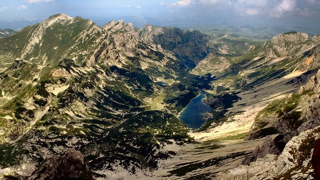
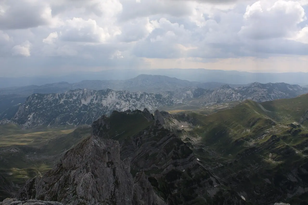
Bobotov Kuk is the 2,523 m limestone tip of Durmitor National Park - the highest summit that sits entirely inside Montenegro. The standard day hike starts at Sedlo pass (1,907 m) on the P14 ring road - the height the national park publishes for the pass, though the Žabljak tourist office lists 1,908 m. That office clocks the out-and-back at about 10 km and 3-4 hours one way. Fit hikers with an early start finish in roughly 5.5-6.5 hours round trip when the weather holds. This page is the summit day itself - approaches, cables, fees and timing - not the park overview.
The massif also throws a longer approach up from Žabljak / Black Lake via Lokvice. Official tourism lists that route but doesn’t publish a kilometre figure for it. Field GPS from hikers who’ve tracked it puts a full return from town at about 20 km and 8.5 hours of walking with no breaks counted. Add lunch, photo stops and route-finding and that’s a 10-11 hour day, so set your start time and turnaround against eleven hours rather than eight. Pick Sedlo unless you’re deliberately wanting a big mountain day with no car shuffle.
What the climb involves
Bobotov Kuk isn’t a gentle ridge walk with a picnic table on top. The final metres sit on brittle limestone with short fixed steel cables - handholds on an airy ledge, not a bolted via ferrata. The Žabljak tourist office calls it the symbolic central summit of Montenegrin mountaineering, and it counts as the country’s high point because it lies wholly on Montenegrin ground; Zla Kolata (2,534 m) is taller on the map, but it stands on the border with Albania.
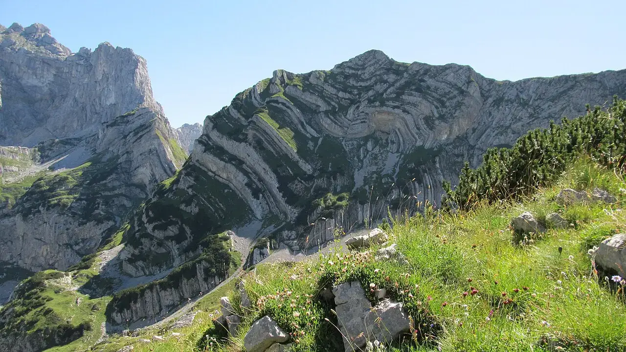
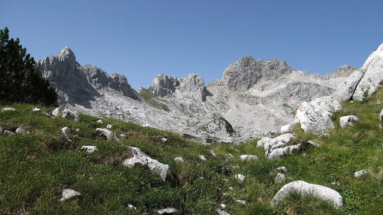
Park managers recommend the signed line Sedlo - Zeleni vir - Bobotov kuk. Marking is the usual Balkan Knafelc (red circle, white centre) plus painted arrows on rock. Stay on those lines: this is a national park, and shortcuts across scree chew the habitat and dump you into gullies that look identical until you’re off-route.
Two approaches: Sedlo vs Black Lake / Lokvice
| Approach | Official figure | Real-world day | Best for |
|---|---|---|---|
| Sedlo pass (P14) | ~10 km RT, 3-4 h up, start 1,907 m (TO Žabljak says 1,908 m), net ~600 m | Usually 5.5-6.5 h RT with breaks; cumulative gain higher than the net because the path dips to Zeleni Vir | Most hikers with a car or taxi |
| Žabljak / Black Lake via Lokvice | Listed by TO, no published km | Field GPS ~20 km RT / 8:30 h walking, breaks not counted - a 10-11 h day | Strong walkers, no car to Sedlo, or a one-way Sedlo→lake day |
| Point-to-point Sedlo → Žabljak | Not on the park price list | Field GPS ~14.4 km / 6:10 h walking, breaks not counted | Taxi up, walk down through the park |
Sources for the table: TO Žabljak Bobotov Kuk page for Sedlo; Moon Honey Travel GPS (updated March 2025) for the longer variants - those aren’t park numbers, and they’re not road-router artefacts. Download an offline map (Mapy.cz or equivalent) the night before; phone signal dies above the treeline.
Sedlo is the sane default. You start already high, the scenery opens immediately, and you still get the cable section that makes the day feel like a real summit. Lokvice from Black Lake is the same mountain with a different warm-up: forest, katun country, then the same convergence at Velika Previja before the final ridge. It’s a proper alpine day - don’t bolt it on after a late breakfast in town.
The Sedlo day, section by section
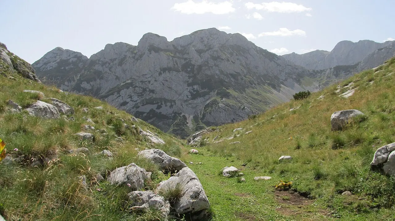
From the informal parking pull-off at the pass, the path trends north under Uvita greda, crosses grassy limestone, and soon hits the first short cable step. After that it rolls through sinkhole country toward the sawtooth Zupci, drops to the small lake bed of Zeleni Vir, then climbs again to Velika Previja - the saddle where the Žabljak trail joins. From the saddle the ledge toward the top is the steepest, most exposed bit. Fixed ropes and rubber-encased cables secure the hardest steps, but they do not run the whole way: between them you are on an open ledge with loose rock and boulder fields underfoot, so let groups pass one at a time rather than squeezing past on the exposed side.
Expect no reliable drinking water after you leave the lower meadows. Carry at least two litres per person on a cool day, three when it’s midsummer. Poles help on the descent across polished limestone. A head torch belongs in the pack even if you plan to be down by mid-afternoon - cloud can slow a group to a crawl.
Getting to the trailhead
Žabljak is the bed-and-breakfast base. How you reach town - bus from Podgorica, coast coaches, hire car or transfer - lives on getting to Durmitor. The 124 km and 2.5-3 hours quoted from Podgorica land you in Žabljak, not at the trail: from Žabljak to Sedlo is another 20-25 minute drive on the Durmitor Ring (P14). There’s no shuttle. Without a car, book a taxi for the morning drop-off (and, if you’re doing the point-to-point, walk out to Black Lake instead of returning to the pass).
Park day tickets are €5 per person on the official list (checked 4 September 2026). There is no hut and no kiosk at Sedlo: a park warden works out of a car and collects the fee in cash, with a card reader sometimes accepted (field report, updated 29 March 2025). The official price list says nothing about payment methods, so treat the card as a bonus and bring notes.
The €13.50 annual card for all Montenegrin national parks pays for itself if you’re stacking Durmitor with Biogradska Gora or Skadar - but buy it in Žabljak, at the tourist information or online through nparkovi.me, before you drive up. The warden at Sedlo cannot issue it, and the parks’ fee decision states annual tickets go to private individuals only, on presentation of a personal ID document.
Two exemptions are worth timing around. Children under 15 enter free under the parks’ published rules, and on 6 September, Durmitor National Park Day, entry to all national parks costs nothing at all. Organised mountaineering-club groups of 20 or more pay half the listed rate.
Unsure about the cables solo? The park’s own guide tariff is €40 for four hours or €80 for eight - or browse organised mountain days via Trip.com tours with a driver and a group already booked.
When to go - and when to turn around
The tourist office window is June to October, and it comes with a warning most summer visitors read too narrowly: TO Žabljak says old snow can linger through the early summer months, meaning June and into July, especially on north-facing aspects. A late-June or early-July date is not automatically a clear mountain. Late October is a gamble on short days and the first freeze. The sweetest stretch for most visitors is mid-July through mid-September, with September quieter and cooler than August. For how that sits against the coast calendar, see when to hike in Montenegro.
Afternoon thunderstorms are the real hazard from midsummer on. Start early enough that you’re off the summit ridge before the sky turns. If the forecast shows electrical activity or a solid cloud bank glued to the peaks, switch to the Black Lake loop (~3.6 km, about an hour) or a lower ridge and keep Bobotov for another day. Turning around at Velika Previja isn’t failure - it’s reading the mountain.
Before you set off: register, tell someone, save the numbers
The Žabljak tourist office is explicit about what it expects from anyone heading up Bobotov Kuk: check the forecast, carry enough water, use proper mountaineering equipment, sign the planinarska knjiga (the mountaineering register), and notify the national park’s local service that you are on the route. The last two are the steps people skip because nobody stops them, and they are the ones that decide how quickly anyone starts looking for you.
Save the numbers before signal drops above the treeline. The rescue and general emergency line is 112; police 122, fire 123, ambulance 124, roadside assistance 19807 (Žabljak tourist office list, checked 4 September 2026). Numbers only get help moving, though - paying for it is your problem. Healthcare here is settled up front and a mountain evacuation is expensive, so check that your policy covers hiking at this altitude and includes helicopter rescue and medical evacuation; our travel insurance for Montenegro guide covers what those clauses actually say.
Gear that earns its weight
Boots with a stiff sole beat trail runners on the polished limestone. Layers: the pass runs markedly colder than the coast, and wind on the summit bites even in July. Sun protection is non-negotiable - there’s almost no shade after the first meadows. Pack a rain shell, snacks for a full day, and a paper or offline map as backup to the phone.
Wild camping rules are park rules - stick to marked sites and the staffed huts. Škrka hut sits on a trail that links toward Bobotov and opens roughly mid-June to the end of September; confirm staffing at the visitor centre before you bank on a bed. Lokvice shelter is a basic year-round bivouac, not a hotel.
After the summit - or instead of it
A clear summit day gives you Tara Canyon, Sinjajevina and, on the best mornings, a hint of Skadar and the Adriatic on the far horizon. Cloudy days still deliver the Šareni Pasovi stripes and the Škrčka lakes below the west face - worth the walk even if you stop short of the plaque.
If Bobotov feels like one peak too far for your group, fold it into a broader Durmitor stay: Black Lake the afternoon you arrive, a moderate ridge the next day, summit when the forecast clears. Neighbourhoods and beds are covered in Žabljak: where to stay. For how Bobotov ranks against the Ladder of Kotor, Grebaje and other country trails, use best hikes in Montenegro as the picker - then come back here when you’ve committed to the 2,523 m day.
Photos
On the map
The map loads on click - to keep the page lightweight.
The map didn’t load. Check your connection and refresh the page.
Admission and opening hours
- Admission price
- Durmitor day ticket €5 per person; all-parks annual pass €13.50; children under 15 free; park guide €40/4h or €80/8h
Prices from the official Nacionalni parkovi Crne Gore list (nparkovi.me/sections/27), checked 4 September 2026; that list sets no payment methods and names no points of sale. Tickets are also sold online. At the Sedlo trailhead a warden collects the fee out of a car - no hut, no kiosk - taking cash, with card sometimes accepted (field report, updated 29 March 2025), so carry cash in case the terminal is down. Confirm the day rate on the spot - lists move.
Details checked: September 4, 2026
Distance ≈124 km · ≈2.5-3 h
- Podgorica ≈124 km · ≈2.5-3 h That is Podgorica to Žabljak, the overnight base - add another 20-25 minutes of driving from town up to the Sedlo trailhead.
Read also

What to see · 10 min read
Swimming in the Bay of Kotor: Beaches & Lidos
Updated · August 31, 2026Can you swim in Kotor? Yes - on Dobrota pontoons, Morinj and small Boka shores. Water quality, season and what to expect.

What to see · 11 min read
Rent a Boat in Kotor Bay: No Licence Needed
Updated · September 5, 2026Private boat rental in Kotor Bay 2026: skippered hire from €90/h, bareboat prices, licence rules, speed limits and where boats leave from.

What to see · 9 min read
Piva Lake & Canyon: Montenegro's Emerald North
Updated · August 27, 2026Piva Lake guide: the 45 km emerald reservoir, Mratinje Dam, boat trips from Plužine, the relocated Piva Monastery and how to pair it with Durmitor.

What to see · 8 min read
Where to Stay in Ulcinj: Old Town vs Velika Plaža
Updated · August 24, 2026Where to stay in Ulcinj: Old Town for atmosphere and Mala Plaža below, or Velika Plaža for 13 km of sand, kitesurf and resort hotels - who each suits.