
Rijeka Crnojevića: Montenegro's Lost River Port
Rijeka Crnojevića: Danilo's 1853 bridge, the village that once ran Montenegro's biggest port, and why its population collapsed to 84.
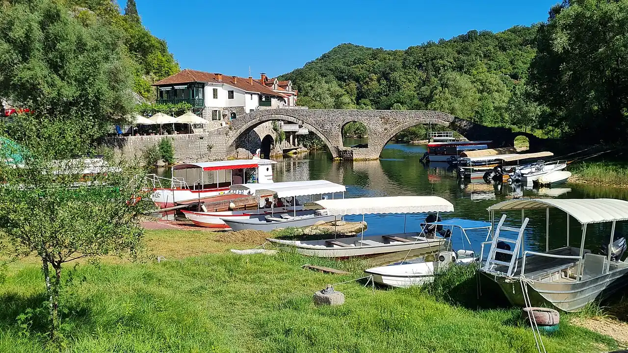
Rijeka Crnojevića was once Montenegro’s busiest river port; today its year-round population is 84. That collapse is the whole story of this village on the northern arm of Lake Skadar, and it’s why the double-arched stone bridge at its centre, built in 1853, still looks oddly grand for a place this size. Most visitors only stop for the Pavlova Strana viewpoint just above the village - one of the most photographed river bends in the Balkans, covered in full in our Lake Skadar guide - but the village below it’s the better story: a trading port that once ran the whole lake, a printing press whose exact home is still argued about, and a population that’s fallen by roughly 90% since the 1960s.
This page is about the village and the bridge specifically. For the national park as a whole - boat trips from all four harbours, the pelicans, the Crmnica wineries and the current €5 park ticket - see the full Lake Skadar guide.
The bridge that gave the village its name
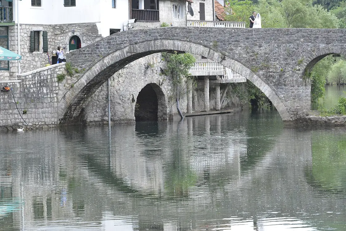
The bridge is the reason the village has a name at all. In 1853, Prince Danilo of Montenegro commissioned a double-arched limestone bridge here, 43 metres long, dedicated to the memory of his father Stanko Petrović. It replaced an older wooden crossing built by his predecessor, the poet-ruler Petar II Petrović-Njegoš, and Danilo also put up a small house beside it known as “Mostina.” That bridge is still standing, still carries foot traffic, and still anchors the handful of restaurants that make this one of the nicer lunch stops in the whole national park.
A capital, then a print shop, then a port
Long before the bridge, this spot was briefly the centre of the Montenegrin state. Ivan Crnojević had fortified the hill of Obod, across the river from the village, around 1475; when the Ottomans overran his fortress at Žabljak Crnojevića in 1478, he moved his seat to Obod and ruled from there until Cetinje took over as the capital. Obod’s real claim to fame came a generation later, and it’s a genuinely disputed one: in 1493 Đurđe Crnojević set up a printing house - the monk Makarije and seven assistants did the actual typesetting - that produced the Oktoih prvoglasnik, completed on 4 January 1494: the first book printed in Cyrillic for the South Slavs and, according to Montenegro’s National Library, only the second Cyrillic press to exist anywhere in Europe. Exactly where it stood is the disputed part - the National Library places it right here on the hill, while at least one other reference account has the press starting out in Cetinje itself, and no hard evidence closes the argument. Wherever the type actually sat, the operation closed after just three years and four more books, but for that brief moment this corner of the country was doing something almost nowhere else in the Orthodox world could.
By the 19th century the village had reinvented itself again, this time as Montenegro’s largest harbour and leading trade centre. Farmers and fishermen from the hills and from Lake Skadar itself shipped their goods through here to the Adriatic - dried bleak (ukljeva), the small lake fish still eaten smoked today, was the local export that made it to Italian tables. Into the 20th century the paddle steamer Skanderbeg ran a regular service between here and Shkodër in Albania from 1924 until Italian occupation forces seized it in April 1941; Yugoslav partisans sank it the following February, right at the mouth of the river below the village.
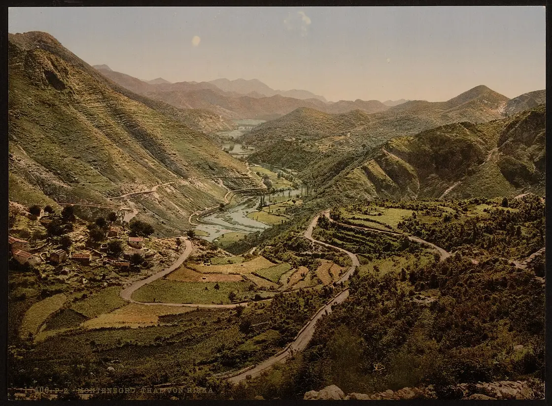
Then it all reversed. Until 1982, the main road between Podgorica and Cetinje ran straight through the village; once a bypass took the through-traffic elsewhere, Rijeka Crnojevića stopped being anyone’s route to anywhere. Combined with the decline of river shipping, the population fell from close to a thousand (with the surrounding hamlets) in the 1960s to 175 at the 2011 census and 84 by the 2023 census - a drop of roughly 90% in two generations, and you’ll feel it walking the quiet lanes above the bridge today.
What the old port left behind
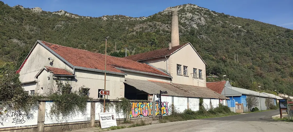
Walk the riverbank today and the old trade is still visible if you know where to look. A disused fish-processing plant with its tall brick chimney still stands by the road into the village, a leftover from the days when ukljeva was packed and shipped from here; its yard now doubles as a signpost for the boat tours that have replaced the cargo trade. On the water itself, traditional reed-roofed wooden boats moor right below the bridge, ready for trips down the winding river channel toward the open lake - a quieter, greener route than the busier crossing from Virpazar, since it runs between reed banks rather than open water for most of its length.
The restaurants are the other reason to linger. Stari Most, right by the old bridge, has built enough of a reputation to get a mention from Lonely Planet, and Konoba Mostina shares the same bridge-side spot with a terrace looking straight down the river. A few hundred metres further along the bank, Poslednja Luka has a similar river view without the crowd at the bridge itself. None of them are secret; it’s the one part of the village that never really emptied out, so expect company at lunchtime in summer even when the lanes above are silent.
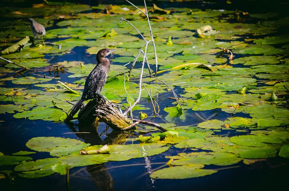
Pygmy cormorants and herons work the reed channels just upstream - part of the same wetland system covered in the birds section of our Lake Skadar guide, which is the place to go for the pelicans.
If wine is part of why you’re here, treat the Crmnica hills - Godinje, Limljani, the Besac showcase fort - as a separate stop near Virpazar on the lake’s south-western shore, not a side trip from this village: it’s a good 40 km by road, not a boat ride from here. Our Montenegro wine guide covers Godinje’s family cellars and their barrel-poured Vranac in full.
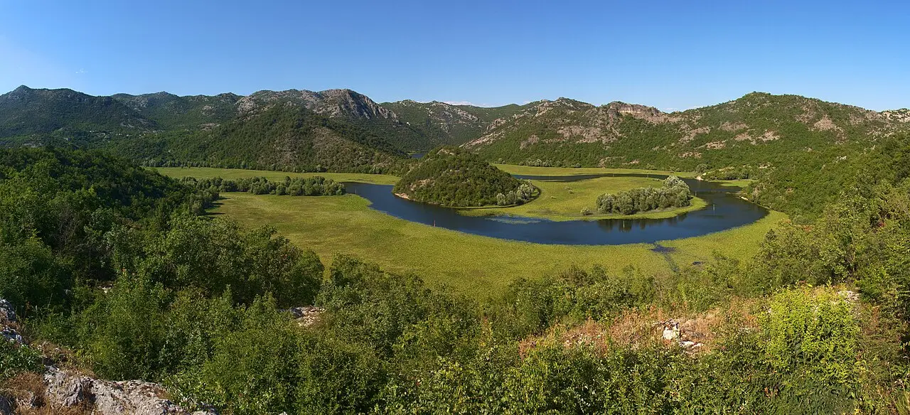
The Pavlova Strana viewpoint, from the village side
The Pavlova Strana viewpoint above the village - the view itself, the best light to catch it, why it’s the most photographed bend on the lake - is covered in full in our Lake Skadar guide. What’s specific to coming from here: a short marked path climbs from the village itself to the viewpoint, and it’s worth the best part of an hour there and back on foot rather than driving straight to the car park at the top.
When to come, and what to bring
Spring and early autumn suit the village best. Summer brings day-trippers off the tour buses at the bridge and sends the swimming crowds instead to Virpazar and the open lake, so the village itself rarely feels overrun even in August. Winter is the wildcard: the same floods that swell the wider national park can leave the fields around the village underwater, which makes the drive in as scenic as the destination but occasionally closes the lower path to the viewpoint - check conditions if you’re travelling between November and March. Whatever the season, carry some cash alongside a card: this is a village of family-run konobas rather than payment terminals, and Montenegro prices everything in euros (€) even though it sits outside the EU.
Getting there without your own car
A car is genuinely the easiest way in: it’s roughly 28 km from Podgorica (30-40 minutes) and about 16 km along the old lake road from Cetinje - the direct route that runs straight down into the village - both drives that reward taking slowly rather than rushing. Without one, it gets harder: there’s no reliable direct bus into the village itself, and the practical workaround is a bus toward Cetinje or Podgorica on the newer bypass road, which can drop you at the Meterizi junction, followed by a long walk down to the bridge - about 6.5 km on the road, closer to an hour and a half on foot, so plenty of people arrange a taxi or a lift for this stretch instead. Check current timetables before you rely on this, since rural routes change without much notice, and don’t assume a bus back out in the evening - plenty of visitors end up arranging a taxi or a lift for the return leg. An organised tour or a transfer booked in advance solves the problem outright if you’d rather not gamble on a rural timetable.
Nearby / read also
- Lake Skadar National Park - the boats, the pelicans, the park ticket and the other three harbours.
- Cetinje - the Old Royal Capital, about 16 km up the old road.
- Podgorica travel guide - the capital, roughly 28 km away.
- Montenegro wine guide - the Crmnica hills and Besac fort, near Virpazar on the lake’s far shore.
- Montenegro travel guide - the whole country, region by region.
Photos
On the map
The map loads on click - to keep the page lightweight.
The map didn’t load. Check your connection and refresh the page.
Distance ≈28 km · ~30-40 min
- Podgorica ≈28 km · ~30-40 min
Read also

What to see · 10 min read
Hiking Bobotov Kuk: Durmitor Highest Peak
Verified · September 4, 2026Bobotov Kuk hike at 2,523 m: Sedlo (~10 km RT) vs Lokvice from Black Lake, €5 park fee, cables, season and early-start tips.

What to see · 10 min read
Swimming in the Bay of Kotor: Beaches & Lidos
Updated · August 31, 2026Can you swim in Kotor? Yes - on Dobrota pontoons, Morinj and small Boka shores. Water quality, season and what to expect.

What to see · 11 min read
Rent a Boat in Kotor Bay: No Licence Needed
Updated · September 5, 2026Private boat rental in Kotor Bay 2026: skippered hire from €90/h, bareboat prices, licence rules, speed limits and where boats leave from.

What to see · 9 min read
Piva Lake & Canyon: Montenegro's Emerald North
Updated · August 27, 2026Piva Lake guide: the 45 km emerald reservoir, Mratinje Dam, boat trips from Plužine, the relocated Piva Monastery and how to pair it with Durmitor.